EN CN

Water Management
and Climate Change

The Jinsha River Basin in China:
on the way to a success story

Learn more about the impacts of climate change and socio-economic development on water resources in the Jinsha River Basin. And how a thorough planning of adaptation measures contributes to the sustainable long-term development of a region. Explore the Sino-Swiss Jinsha River Basin project in China.

Tools and Products

Project Background

The Yangtze River Basin is the socio-economic powerhouse of China. The upper reach of the Yangtze River is called Jinsha River. In the last 2-3 decades, the Jinsha River Basin has experienced warmer temperatures and increasing extreme events such as flood and drought, causing significant economic loss. At the same time, different sectors and stakeholders are very sensitive to water issues and climate change: Industry, residential areas, hydropower, agriculture, ecosystems and tourism.

A Sino-Swiss cooperation project

To improve the overall water resource management in the Jinsha River Basin and to adapt successfully to climate change and socio-economic development, Switzerland and China have launched this project. Lijiang, located in the north-western part of Yunnan Province, serves as a pilot region where the current water situation and their trends are analyzed. Switzerland and China have been cooperating for over ten years in the areas of water management and climate change. Both countries are severely affected by the impacts of climate change on water resources.

Use the map and find out more about the Jinsha River Basin!

  • Yangtze-Overview
  • Project Area

Jinsha River

The Jinsha River has its source in the Tibetan Plateau and runs mainly through Qinghai, Yunnan and Sichuan Provinces in the south-west of China. The Jinsha River drains 26% of the total catchment area of Yangtze River.

Yangtze River

With its 6,000+ km, the Yangtze River is the longest river in China and the third longest in the world. Its basin covers an area of 1.7 million km2, encompassing about one fifth of China’s total territory.

Jinsha River Basin

In the Jinsha River Basin the local water regime is greatly influenced by glacier and snow melt runoff and climatic variability. In recent years, extreme events like floods and droughts have increased. Climate change has significant impact on water resources and biological diversity.

Lijiang

Lijiang City, pilot region of the project, has experienced increasing water crises in the last 2-3 decades: Spring water ponds and river courses have started to dry up. The degradation of the riverine ecology is increasing. At the same time, the demand for water, especially in agriculture and tourism, is growing.

Yulong Snow Mountain

Glaciers are important components of the water cycle. For the glacier of Yulong Snow Mountain, strong retreat has been observed. Therefore, the investigation of its current situation and changes is of high relevance.

Objectives

The long-term project objective consists of the improvement of the integrated water resources management for the Jinsha River Basin under conditions of changing climate and social-economic development. It aims at effectively protecting life and assets, ensuring water security in the region, contributing to the sustainable development of the Chinese economy, and to a source of learning for global water and climate change discussion.

The main purpose of this three year project is to create a foundation of integrated water management tools and products in this region for the future. Therefore, the main objectives are to:

    • Improve the knowledge of water dynamics and aquatic ecosystems in the Jinsha River Basin substantially;
    • Identify impacts of climate change on water resources and extreme events;
    • Create ideas of adaptation strategies and measures for water resources and extreme events considering aquatic ecosystems;
    • Exchange knowledge and expertise on water resources management and climate change adaptation between Chinese and Swiss experts, and disseminate to the international community.

Sectors and Stakeholders

In the Jinsha River Basin different sectors and stakeholders are affected by climate and socio-economic change. Today, all these sectors and stakeholders strongly depend on water. The Jinsha River Basin Project aims at a sustainable balance between water supply and demand in the future for these sectors.

Residential areas

Residential areas

Urbanization and population growth are a strong trend in China and in the Jinsha River Basin. The increasing number of urban dwellers leads to a higher water demand and consumption. Proper and sustainable management of water supply and demand will ease tensions and conflicts in the future.

more

Agriculture

Agriculture

The region maintains a strong agricultural focus. Tobacco is the main export product, mainly in Yunnan and Sichuan Provinces. The livelihood of the majority of the rural population is highly dependent on agriculture and thus vulnerable to the effects of droughts and floods. Given the high demand on water for traditional irrigation, this project will indirectly affect their well-being and vulnerability.

more

Hydropower

Hydropower

Massive investments in hydropower are planned and implemented by the Chinese government in this region. 42 cascade hydropower stations are planned and partly constructed in the Jinsha River Basin along the main stream and the Yalong river, which will influence the hydrology of the entire basin. Some trends predict less water in the future, thus electricity production is expected to decrease. The project will contribute to an optimization of the operational management of the hydropower reservoirs that matches the needs of all water pillars.

more

Ecosystem

Ecosystem

Humankind benefits in many ways from ecosystems. Ecosystems in the region ensure important services such as flood mitigation, water purification, fish habitats as well as recreational and cultural functions. Changes in temperature and precipitation will largely affect ecosystems which will result in adverse impacts on human beings. Appropriate water resource management will help to prevent that.

more

Industry

Industry

The main manufacturing industries are heavy industries such as coal, iron, steel and copper production. These industries are growing fast. Their production depends heavily on water. Appropriate water resource management can secure the water supply for those users, and on the other hand, manage the risk associated with water pollution, which is critical for other water users.

more

Tourism

Tourism

Tourism is a growing business sector in the Jinsha River Basin, especially in the Lijiang area where the ancient town has been recognized as a UNESCO World Heritage Site. Higher water demand for tourism is expected in the future. The project aims to achieve a sustainable future balance between water supply and demand in the region.

more

Tools and Products

To foster integrated water management, we improved the knowledge of water characteristics, extreme events and aquatic ecosystems in the Jinsha River Basin substantially. With this as a baseline, we identified impacts of climate change and socio-economic development on water resources and extreme events. As a third step, we created ideas of adaptation strategies and measures. Explore our tools and products!

Know more about Water Characteristics, Extreme Events and Aquatic Ecosystems

Know more about Water Characteristics, Extreme Events and Aquatic Ecosystems

learn more

Predict Runoff, Prevent Flooding: A Forecasting Model

Predict Runoff, Prevent Flooding: A Forecasting Model

learn more

Water Supply and Demand: An Evaluation and Planning Tool

Water Supply and Demand: An Evaluation and Planning Tool

learn more

Glacier and Snow Melt Monitoring Capability Improved

Glacier and Snow Melt Monitoring Capability Improved

learn more

Impacts of Climate Change

Impacts of Climate Change

learn more

Adaptation Strategies and Measures for the Future

Adaptation Strategies and Measures for the Future

learn more

Main Project Results

  • Jinsha River Basin
  • Middle and Lower Basin
  • Lijiang City

Hydro-Meteorological Data Analysis

We developed a hydro-meteo­rological data analysis tool. It allows further analysis of temperature and precipitation trends observed in the past showing a clear trend of temperature rise.

Historical Extreme Events

We developed a new standardized event registration platform. It is beneficial to record, visualize and analyze heterogeneous event data sets. Main characteristics like people and areas affected and economic damage have been registered.

Satellite Monitoring

Based on the satellite remote sensing data, we analyzed snow cover and snowmelt runoff in the lower part of Jinsha River.

Predict Runoff, Prevent Flooding

We established a new forecast model that allows hydrological forecasting for more than 50 locations in Jinsha River Basin. The new tool supports decision making and contributes to enhance flood alert and reservoir regulation.

Temperature and Precipitation Predictions

For the downstream part of the Jinsha River Basin, a temperature rise of 1 – 2°C in the near future and 1.5 – 5°C in the far future is expected. Most climate change scenarios show an increase in precipitation for the upstream and middle part of the region, whereas the change for the downstream part is uncertain.

Climate Change Scenarios

A set of 8 climate change scenarios for the expected daily temperature and precipitation in the near future (2021 – 2050) and 16 in the far future (2070 – 2099) was elaborated.

Legend Water Characteristics and Dynamics Climate Change Scenarios and Impact Analysis Adaptation Strategies and Measures

Climate Change Impact Assessment

Based on the climate change scenarios we assessed the impacts on several sectors like hydropower, agriculture, extreme events floods and droughts and aquatic ecosystems.

Impacts on Cold-Water Fish

Rising water temperature ­caused­­ by climate change is one the most important factor affecting cold-water fish habitat factors. However, hydropower plants have a greater impact on fish ecology than climate change because dams block fish migration paths to their optimal habitats in various phases of their life-cycle.

Shifts in Agriculture

With the increase of yearly precipitation and temperature, the area suitable for the culti­vation of important crops may raise, shifting further north and to higher altitudes. However, the water demand of crops is expected to increase.

Hydropower: Increase of Runoff

Average annual runoff as well as runoff during the wet season are expected to increase. However, due to limited turbine capacity, hydropower production will not increase proportionally.

Case Study: Extreme Events

We elaborated exemplary measures to adapt to floods as well as agricultural and hydrological drought events in selected re­gions and analyzed challenges for affected sectors and stakeholders.

Legend Water Characteristics and Dynamics Climate Change Scenarios and Impact Analysis Adaptation Strategies and Measures

Predict Runoff, Prevent Flooding

We established a new forecast model that allows hydrological forecasting for more than 50 locations in Jinsha River Basin. The new tool supports decision making and contributes to enhance flood alert and reservoir regulation.

Glacier Observation Station

The station provides basic data support for understanding the impact of climate change on glacier melting and runoff. For the first time, glacier changes on Yulong Snow Mountain are visualized by real-time monitoring.

Water Conflicts in Lijiang

The situation in Lijiang City will become more critical, especially during the dry season. The water demand for agricultural irrigation is expected to increase by 3 % to 7 %. Due to urbanization and an increase in tourism, domestic water demand is expected to double.

Case Study: Water Supply and Demand

We developed a Water Evaluation and Planning Model that reproduces the current and future water supply and demand situation in Lijiang. In a case study, we evaluated 52 adaptation measures to reduce water scarcity in Lijiang. They are used in the planning process of local management authorities.

Legend Water Characteristics and Dynamics Climate Change Scenarios and Impact Analysis Adaptation Strategies and Measures

Conferences and Publications

Are you interested in knowing more about the Jinsha River Basin Project? Check out the presentations of the conferences about the project or read our publications:

Conferences

  • 7th Sino-Swiss High-Level Dialogue on Water Management,
    August 2016, Beijing, China
  • JRB Mid-term Conference,
    November 2016, Lijiang, China
  • 9th International Conference on Water Resources and the Environment,
    January 2017 Wuhan, China
  •  JRB Final Conference, May 2018, Beijing, China

Project partners

Jinsha River Basin project is a Sino-Swiss cooperation involving the public and private sectors of both countries.

Sino-Swiss Steering Committee
Chinese Partners
Swiss Partners

Contacts

Imprint

Concept, Content & Webdesign
EBP Schweiz AG
Cornelia Büttner + Monika Rohner
Zollikerstrasse 65
CH-8702 Zollikon
kommunikation@ebp.ch
www.ebp-kommunikation.ch

Technical implementation
Odoson
Robert Baumgartner
Carrer d’Ali Bei 7, 2-2
ES-08010 Barcelona
hello@odoson.com
www.odoson.com

Copyright
© 2017 EBP

Liability limitations
The content of this website was created with reasonable care. However, EBP Schweiz AG does not guarantee the accuracy of information from third parties. Links to other websites are not under the control of EBP Schweiz AG.

Know more about Water Characteristics, Extreme Events and Aquatic Ecosystems

As a fundamental basis for integrated water management, knowledge about water characteristics, water-related natural extreme events and aquatic ecosystem in the Jinsha River Basin is crucial. We improved this knowledge substantially.

Better knowledge of hydro-meteorological characteristics

We collected and analyzed the hydro-meteorological data for the region from the last 50 years in order to gain a better understanding of the water characteristics under different climate conditions in the past. In particular, we compiled and analyzed daily meteorological data (precipitation, minimum, average and maximum temperature) of 45 stations (31 of which were within the basin) and data from 5 hydrological stations (daily discharges).

The legendary first bend of Yangtze River near Shigu in Yunnan Province.

An important aspect of this work has been the elaboration of the HydroAnalysis package, a structured R-tool developed specifically for the project to apply different data analyses: basic statistics calculation, frequency, trends and drought analyses.

In general, we identified no significal trends in the duration, magnitude or intensity of short, medium and long term drought events. However, a certain increasing trend in the number of rainy days per year has been detected in the upper part of the Jinsha River Basin, and a reducing trend in stations in the lower part.

The results of this research helped to make a plausibility check on the climate change projections and the respective trends on the climate variables.

Overview of historical extreme events

Water-related natural extreme events can strongly influence water resource management. The occurrence, magnitude and consequences of such events should be analyzed and understood in order to create a foundation for a thorough planning of adaptation measures and the long-term development of the region. For this, we developed a web-based natural hazard event registration platform for the Jinsha River Region. It can be used for both event data registration or browsing registered events. Collected data and information for about 60 events of different natural disaster types (floods, droughts, debris flows and landslides) have so far been registered in this platform, including information sources, affected areas, duration, spatial and temporal distribution, damage and financial loss.

We have set up a database for extreme events to record severe floodings like the ones in China in July 2016

Check out the results of the study: Factsheet Understanding the Characteristics of Historical Extreme Events

Analysis of aquatic ecosystems

In recent years, the aquatic ecosystem of the Jinsha River has experienced significant changes due to the construction of hydropower stations. Furthermore, coldwater fish species which are widely distributed in the Jinsha River will be increasingly under pressure due to climate change. Therefore, research has been carried out with a special focus on the fish communities and habitats. The results provide detailed information on the diversity of aquatic organisms, current ecosystem health levels and the vulnerability of the aquatic ecosystem, indicating needs for ecosystem protection and restoration.

The current condition of the aquatic ecosystem in the Jinsha River has been analyzed in order to provide information about the phytoplankton, zooplankton, zoobenthos and – with a special focus – the fish. The quality of fish habitats in different river sections was assessed by using a Fish Index of Biological Integrity (IBI).

The results show that today’s aquatic ecosystems in the area manifest high biodiversity. However, coldwater fish species are very sensitive to climate change and impacts of hydropower. Thus, sustainable adaptation and protection measures in the Jinsha River Basin need to be implemented.

In the Jinsha River Basin, coldwater fish species are very sensitive to climate change and the impacts of hydropower.

Check out the results of the study: Factsheet Overview of Aquatic Ecosystem in Jinsha River

Predict Runoff, Prevent Flooding: A Forecasting Model

In the past and future decades, numerous hydropower reservoirs have been and will be built in the Jinsha River Basin. As part of the analysis of the water characteristics of the region, we elaborated a hydro-meteorological forecasting model in which the large reservoirs are integrated.

With respect to the runoff prediction and flood prevention requirements, we established a hydro-meteorological forecasting model. The model has been incorporated into the existing forecasting system of the Changjiang Water Resources Commission (CWRC). The results can provide data reference and a decision-making basis for CWRC to command flood prevention, and hence enhance the commission’s capability in terms of runoff prediction and flood prevention management.

We included data from almost 400 rainfall gauging stations, over 70 discharge gauging stations and a dozen large reservoirs in the model. Real-time transfer of weather forecasting data from the Weather Research and Forecasting Model and the Bureau of Hydrology at CWRC to the database has been programmed. The Routing System model is used for the entire Jinsha River, covering more than fifty forecasting points.

Runoff forecasts in different regions of the Jinsha River Basin are therefore possible, and operation of the reservoirs included can be optimized. Results from model runs will also be used to estimate impacts of climate change on the future water resource and hydropower production in the region.

Hydro-meteorological gauging station at Er Lake near Dali, as part of the forecasting system.

Check out the results of the study: Factsheet Hydro-meteorological Forecasting Model

Water Supply and Demand: An Evaluation and Planning Tool

Lijiang municipality is a fast-developing region in the Jinsha River Basin. A case study has addressed the challenges of water resources management in each town of Lijiang. Based on a water allocation model, the analysis and results give a detailed picture of the current and future water supply and demand situation of Lijiang, and indicate the needs for integrated water management measures.

The water allocation model reproduces the water supply and consumption status in Lijiang. This provides a fundamental basis for the future water resources planning for Lijiang.

In the model, we included more than sixty water supply infrastructures such as rivers, lakes, reservoirs, and about 270 water demand sites including agriculture, industry and drinking water.

With help of the model, future socio-economic and demographic trends can be assessed. Thus, a solid basis is given to the local authorities for sustainable decision-making regarding water resources management in the future.

The model could be duplicated to be used for other regions or cities in China.

A sequence of the water supply channel and irrigation system in Lijiang. Our work and studies will help to improve the water management system.

Check out the results of the study: Factsheet Water Resources Management in Lijiang

Glacier and Snow Melt Monitoring Capability Improved

Glaciers and seasonal snow cover in the Jinsha River Basin are important components of the water cycle. Therefore, the investigation of their current situation and changes is of high relevance.

Terrestrial glacier monitoring and satellite-based snow cover monitoring will improve the understanding of the status and dynamics of different factors such as snow melt, glacier melt, droughts, floods, and their impacts on the water resources in the region.

To increase climate change detection capability, we designed enhanced monitoring equipment for Yulong Snow Mountain. By using this equipment, the glacier monitoring capability will be significantly improved. Operation of the automatic glacier monitoring station can greatly reduce the manual measurement workload and improve monitoring efficiency.

Furthermore, we created a Snowmelt Runoff Model to analyze changes in snow cover of different altitudinal zones.

The two monitoring systems are important tools for the research team to record changes in glacier and snow melt, and to deliver true evidence for the public to understand climate change.

We designed and installed enhanced glacier monitoring equipment for Yulong Snow Mountain, to increase detection capability of climate change.

Check out the results of the study: Factsheet Snow and Glacier Monitoring System

Impacts of Climate Change

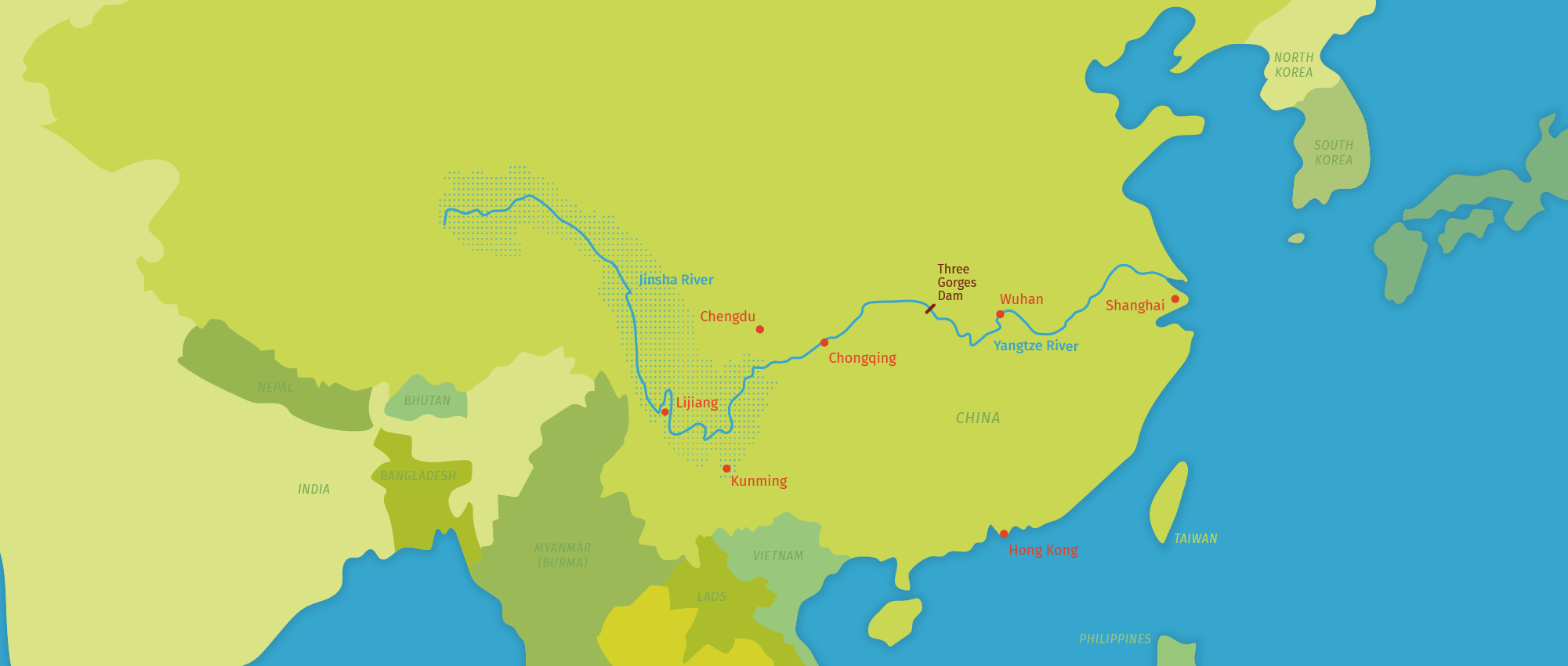
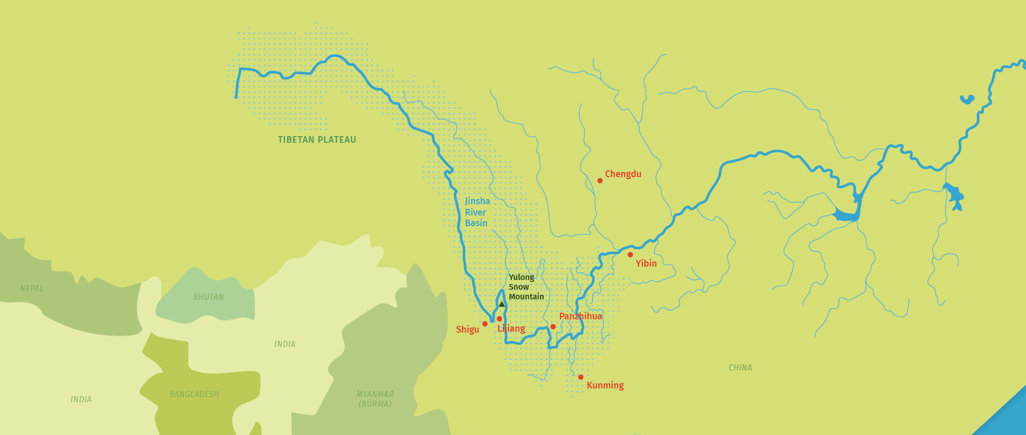
What are the impacts of climate change on water supply, extreme events and aquatic ecosystems in the Jinsha River Basin? We analyzed these impacts based on climate change scenarios for temperature and precipitation. Water characteristics which we elaborated earlier served as a baseline.

Climate change scenarios

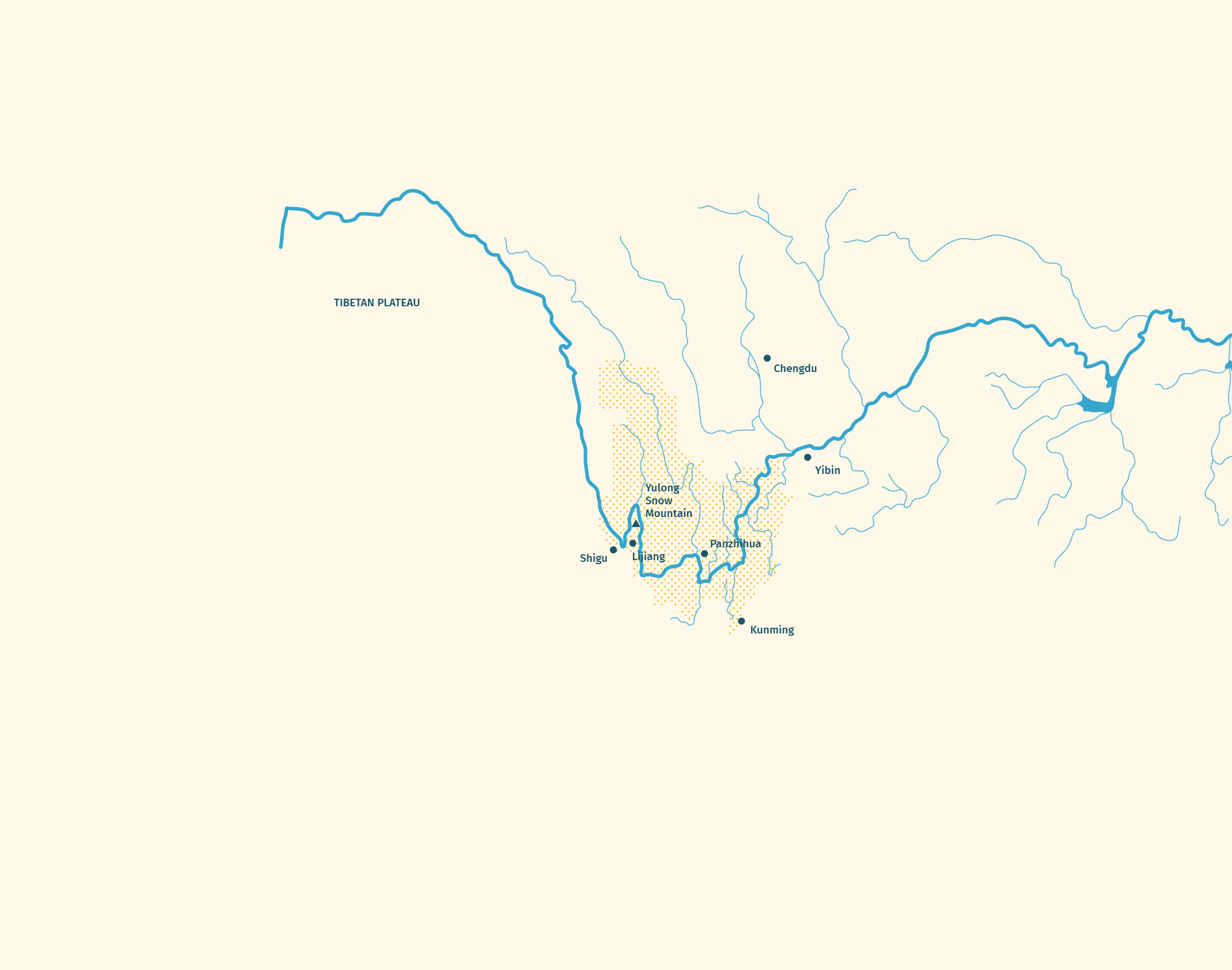
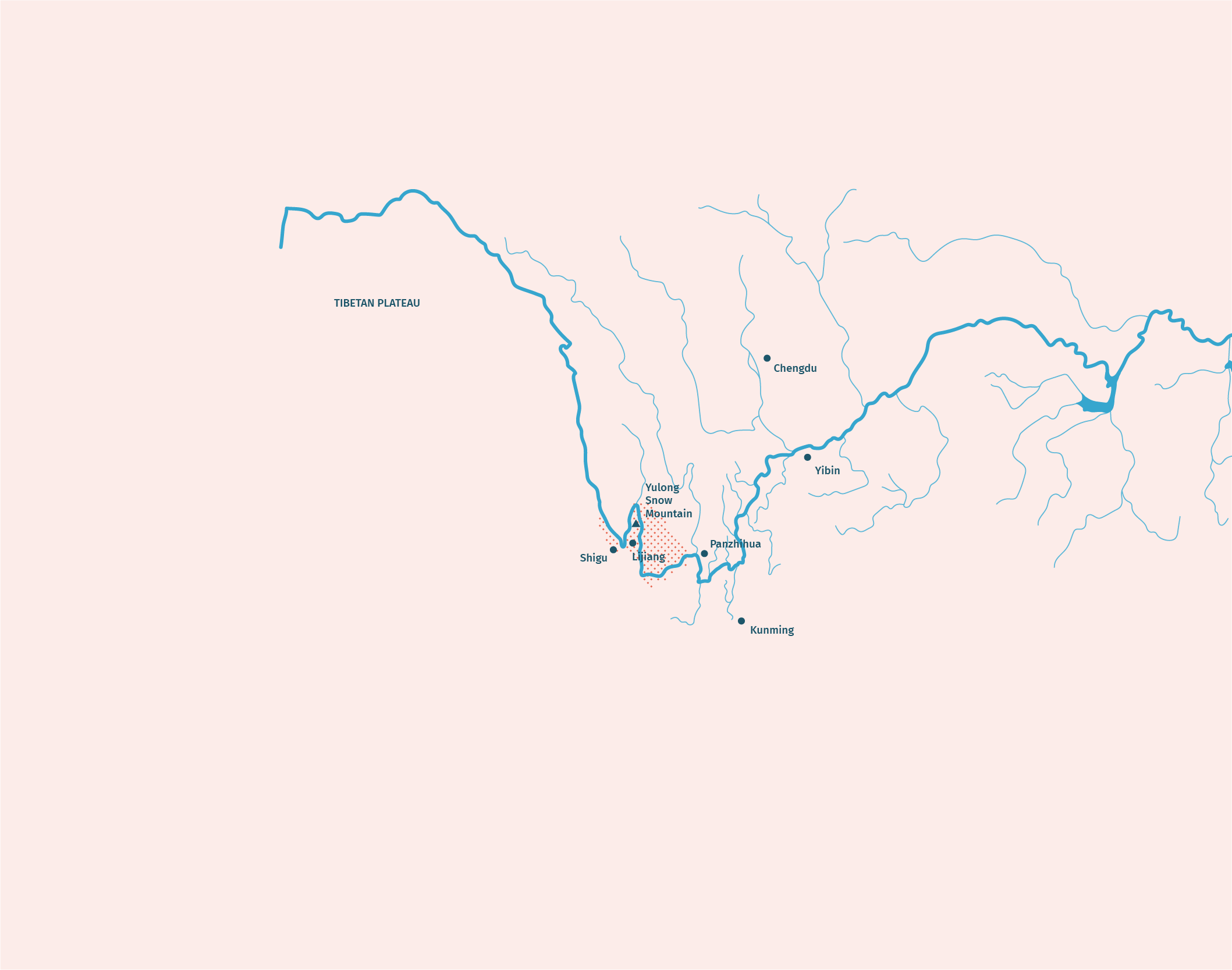
Scenarios describing expected climate change in the Jinsha River Basin are of critical importance to understand how climate change affects the sustainable use of water resources and extreme events such as floods and droughts. Based on the predictions of multiple general circulation models (GCM) we elaborated a set of 24 climate change scenarios for daily temperature and precipitation on a grid covering the entire Jinsha River Basin. 8 scenarios cover the near future (2021-2050) and 16 scenarios cover the far future (2070-2099). The use of several climate scenarios forms the basis for a subsequent uncertainty analysis regarding the impacts of climate change.

For the downstream part of Jinsha River Basin, a temperature rise of 1 – 2°C in the near future and 1.5 – 5°C in the far future is expected (compared to the 1981 – 2010 baseline). Whereas the trend towards higher temperatures is unambiguous, the trend in average precipitation is more uncertain. Most climate change scenarios show an increase in precipitation for the upstream and middle part of the Jinsha River Basin, whereas the change for the downstream part of the region is uncertain. This corresponds to current trends, which underlines the plausibility of the climate change forecasts.

Check out the results of the study: Factsheet Climate Change Scenarios

Impacts on different sectors and stakeholders

For the entire Jinsha River Basin, we analyzed impacts of each climate change scenario on sectors like hydropower (e.g. electricity production), agriculture (e.g. crop suitability) and aquatic ecosystems (e.g. fish habitat quality). The impact assessment included extreme events (e.g. flood frequency, flood intensity, flash floods, agricultural and hydrological drought). Additionally, we have studied the impacts on industry, residential areas/tourism and agriculture for the Lijiang area, by analyzing water balance, identifying water deficits and considering future socio-economic trends.

Opportunities and challenges due to climate change have been identified and form the basis for adaptation strategies and measures.

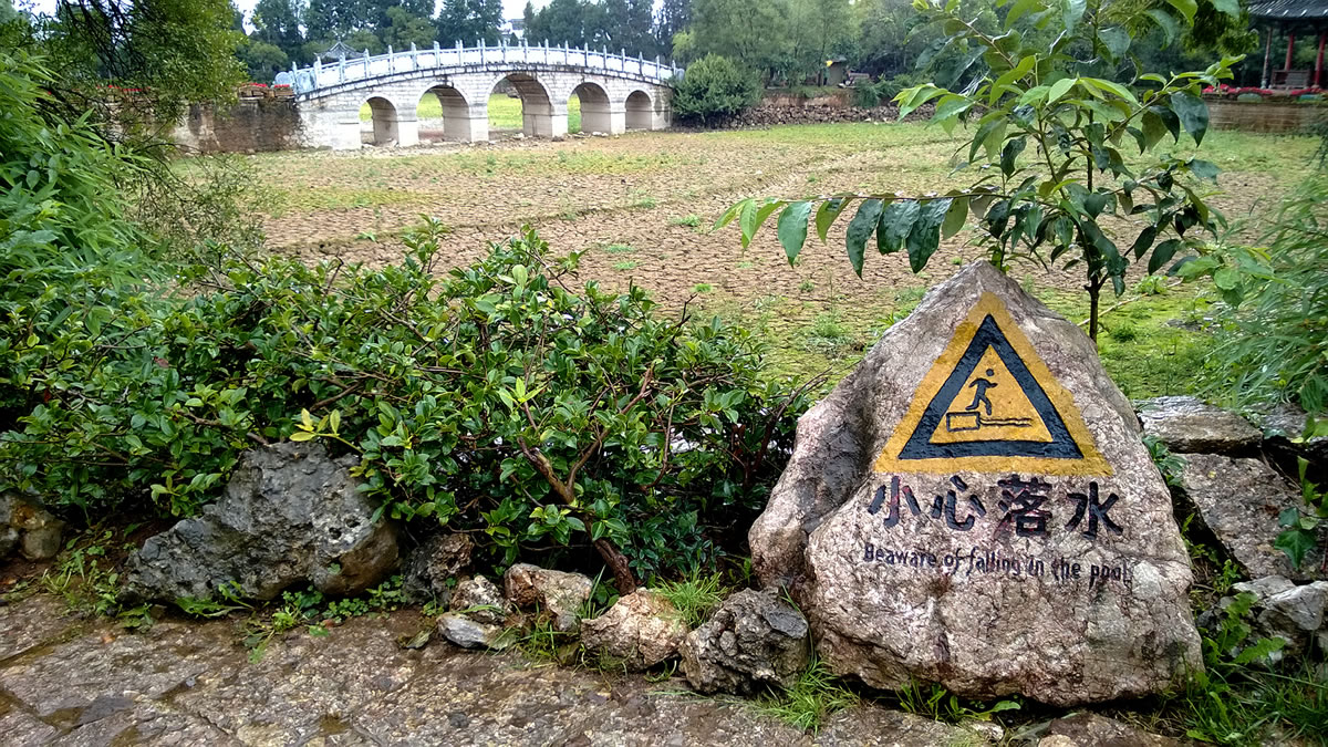
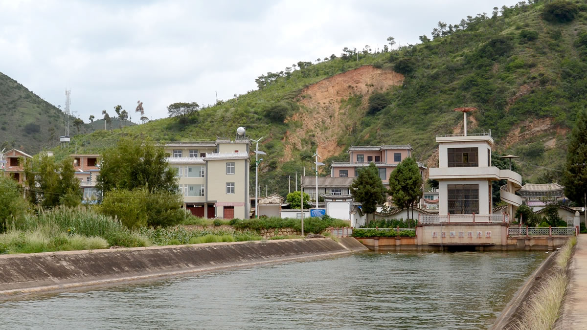
Lijiang has experienced increasing water crises in the last 2-3 decades. River courses and ponds such as Black Dragon Pond have started to dry up.

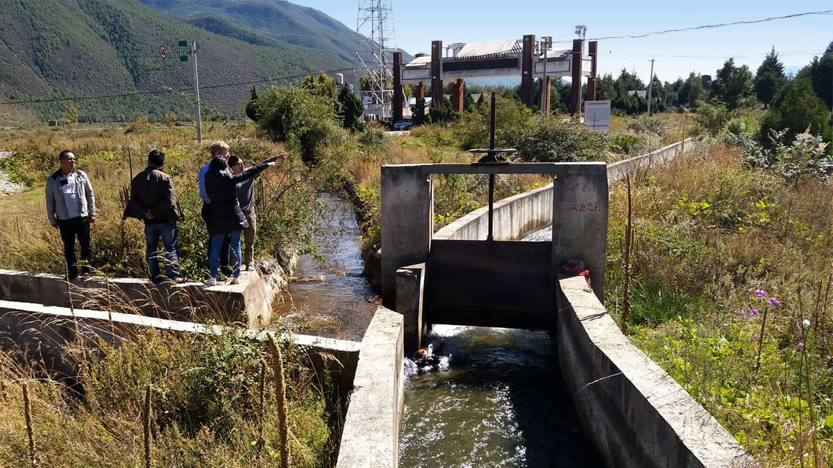
Impacts on water supply and demand in Lijiang City

The impact on water supply and demand in Lijiang City we evaluated using a water allocation model. The results show that the future demand for agricultural irrigation water is expected to increase by 3% (near future) to 7% (far future); due to urbanization and an increase in tourism, domestic water demand is expected to double. The assessment shows that Lijiang is already suffering from water scarcity today. And the water supply and demand situation will become more critical in the future, especially during the dry season.

Impacts on extreme events

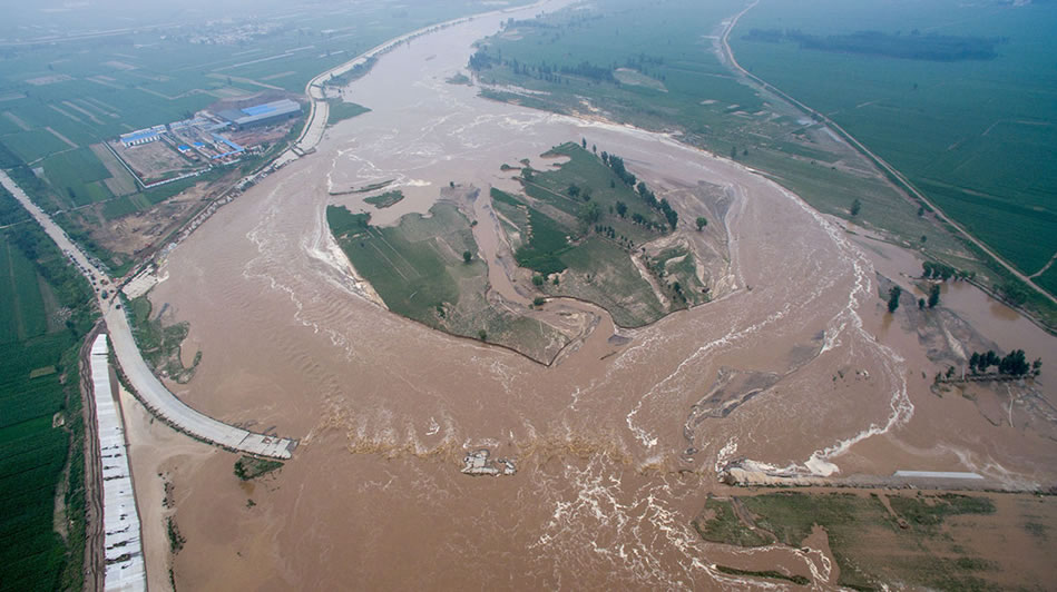
We analysed the frequency and intensity of different types of extreme events such as flood and drought in the Jinsha River Basin under 24 different climate scenarios. The results indicate that for mainstream river floods of a given occurrence rate, flood intensity is expected to increase significantly. These results should draw attention to further review the design of flood capacity measures and the management of events, where given thresholds (e.g. warning levels) are exceeded.

Residential areas, agriculture, industry, critical infrastructure, energy production, waterways and ecosystems are mainly affected by extreme events influenced by climate change. Impacts consist mainly of financial losses, but also of fatalities due to flash floods.

Due to the rising number of days with intense rain, flash floods in tributary areas are expected to occur more frequently in the future, creating more damage.

During the dry season, increasing evaporation due to higher temperature dominates possible changes in precipitation patterns. Therefore, the frequency of hydrological drought events will increase. Regarding agricultural drought, there can be a significant increase in crop water demand due to rising evapotranspiration, which could, if irrigation water is scarce, lead to a higher frequency, intensity and duration of agricultural drought events.

Impacts on aquatic ecosystems

The water temperature rise is the most important factor affecting cold-water fish habitat by shortening their spawning period. The interactions among different species will induce variations into the fish community structure and eventually result in many ecological responses such as alterations in species distributions, reduced biodiversity, invasion of alien species and food web structure.

Furthermore, the combined effects of hydropower stations such as impoundment, alteration of hydrological regimes, blocking effect and hypolimnetic discharges will accelerate the ecosystem’s degradation. The restoration of longitudinal connectivity should be a high priority of rehabilitation works in these systems to make essential spawning habitat accessible.

Impacts on hydropower

Average annual runoff as well as runoff during the wet season are expected to increase significantly. However, due to limited turbine capacity, hydropower production will not increase proportionally.

Impacts on agriculture

With the increase of yearly precipitation and temperature in the Jinsha River Basin, the area suitable for the cultivation of important crops may raise, shifting further north and to higher altitudes. However, the water demand of crops is expected to increase.

Adaptation Strategies and Measures for the Future

Based on our analysis of impacts of climate change and socio-economic development on water supply and extreme events in Jinsha River Basin, we created ideas of adaptation measures to water resources management, flood control and drought relief in case studies. Additionally, we outlined principles for a long-term climate change adaptation strategy.

Case Study: Water Supply and Demand

In this project we developed a Water Evaluation and Planning Model that reproduces the current and future water supply and demand situation in Lijiang.  Our analysis showed that the city is already suffering from water scarcity today. The water supply and demand situation will become more critical in the future, especially during the dry season.

We evaluated 52 adaptation measures to reduce water scarcity in Lijiang. Our analysis of existing or already planned measures to reduce water scarcity in Lijiang City has shown that most of the planned measures are engineering measures on the water supply side. Non-engineering measures on the demand side and infrastructure management show a good performance that could be considered as additional adaptation options. We recommended a set of additional adaptation options such as reservoir management, water saving and water reuse, optimized crop selection and cultivation technologies.

Our Water Evaluation and Planning Model provides a useful basis for the Lijiang Water Bureau to properly and comprehensively deal with climate change and socio-economic developments. The project’s research findings partially contributed to the “Lijiang Ecological Water Network Construction Planning” and “Lijiang Water Conservancy Development 13th Five-Year Plan”.

Case Study: Extreme Events

In the case study of extreme events we elaborated exemplary measures to adapt to floods in Jinsha mainstream as well as to agricultural and hydrological drought events in Jinsha downstream area.

To protect Yibin City from a mainstream flood in the far future, about 80 percent of the storage capacity of the reservoirs Xiangjiaba and Xiluodu seems to be needed. Since part of the retention volume of the two reservoirs must be retained to protect other cities, adaptive reservoir management is required.

Regarding drought relief, it is expected that the impacts of climate change which influence hydrological droughts on the three analyzed projects (Panzhihua Urban Water Supply Project, Central Yunnan Diversion Project, Xiangjiaba Irrigation Area Project) will be mitigated by the planned cascade reservoirs in the middle and lower reaches of Jinsha River Basin mainstream.

In general, our analysis of existing measures to reduce flood and drought risks has shown – similar to the Lijiang case – that most of the planned measures are engineering measures for flood control and drought relief. Non-engineering measures received less attention. However, the evaluation of non-engineering measures such as monitoring systems, hazard and risk mapping etc. shows a good performance, so that such measures are recommended to be worked out in more detail and eventually implemented in addition to the already planned measures.

Long-term Climate Change Adaptation Strategy

Based on these case studies, we outlined principles for a long-term climate change adaptation strategy for Jinsha River Basin. Important elements of this strategy are overall objectives of the adaptation activities, the political and institutional framework, capacity building and sensitization as well as the concrete adaptation measures. The embedding in existing strategies and policies is an important aspect to be considered in the elaboration of the long-term adaptation strategy.

了解更多关于水资源特征、极端气候事件和水生态系统的信息

了解金沙江流域的水资源特征、与水资源相关的自然极端气候事件和水生态系统是至关重要的,这是进行水资源综合管理的基础。我们充分增进了对这方面的了解。

更好地了解水文气象特征

我们收集分析了该地区过去50年内的水文气象资料,通过整理分析了45个国家气象站(其中31个位于流域)的气象要素(降水,最高、最低和平均温度)以及5个水文站的流量资料(日均流量),可以更好地了解过去不同气候状况下的水资源特征。

传说的长江第一道弯,位于云南省石鼓镇附近。

这项工作的一个重要方面就是编制HydroAnalysis软件包,这是一个结构化的R-tool,专为该项目进行不同气象水文资料分析而研发:基本统计特征、频率、趋势和干旱分析。

总体而言,短期、中期和长期干旱事件的持续时间、强度大小没有明显的变化趋势。但是,我们发现位于金沙江流域上游一些站点的有雨日天数呈增加趋势,而位于下游流域的站点呈现减少趋势。这项研究结果有助于对气象要素的情景预测和相关趋势进行合理性分析。

历史极端气候事件概述

与水资源相关的自然极端气候事件会对水资源管理造成强烈影响。为了给该地区的适应性措施和长期发展规划奠定基础,必须分析、了解此类事件的发生、严重程度和后果。因此,我们在金沙江流域建立一个自然灾害事件登记的网络平台。该平台可以用来录入极端事件信息或浏览已录入的事件。目前为止,该平台已录入了大约60个不同的自然灾害事件(洪水、干旱、泥石流和山体滑坡)的资料和信息,包括信息源、受灾地区、持续时间、空间与时间分布、损害和经济损失。

我们已建立了一个极端气候事件数据库,以记录严重的洪水泛滥事件,如20167月中国所发生的洪灾。

查看研究结果:宣传页 了解历史极端气候事件的特征

水生态系统分析

近年来,由于水电站的建设,金沙江水生态系统已发生了重大变化。此外,由于气候变化,广泛生长于金沙江的冷水鱼类将会面临很大的生存压力。因此,项目开展了针对鱼类种群和栖息地的研究。

研究结果提供了关于水生生物的多样性、生态系统的健康水平现状和水生态系统的脆弱性的详细信息,结果表明生态系统需要保护和恢复。

为了获取关于浮游植物、浮游动物和底栖动物(尤其是鱼类)的信息,项目组对金沙江水生态系统的现状进行了分析。利用鱼的生物完整性指数(IBI)来评估不同河段的鱼类栖息地质量。

结果表明,该地区现状水生态系统有很高的生物多样性。然而,冷水鱼类对气候变化和水电站的影响十分敏感。因此,在金沙江流域需要实施可持续的适应及保护措施。

在金沙江流域,冷水鱼类对气候变化和水电站的影响十分敏感。

查看研究结果:宣传页 金沙江水生态系统概况

预测径流,预防洪水:预测模型

在过去及未来的数十年内,金沙江流域已建且规划建设多座水电站和水库。作为流域水文情势特征分析内容的一部分,我们建立水文气象预报模型,模型中考虑了大型水库的建设。

考虑径流预报和防洪需求,我们建立了一个水文气象预测模型。该模型已接入了长江水利委员会已有的水文预报系统。其结果可为长江水利委员会指挥防洪提供参考和决策依据,从而提高长江委在径流预测和防洪管理方面的能力。

本模型中的数据来自于近400个雨量站、70多个流量站和12个大型水库的实测数据。模型可以通过从已有气象预报模型和水文局实时传送气象预报数据。水文预报模型可以用于整个金沙江,覆盖了五十多个预测点。

因此,在金沙江流域不同地区进行径流预报是可行的,水库的运行方式也可以得到优化。模型模拟结果也将被用来估计气候变化对该地区水资源和水力发电的影响。

大理附近的洱海气象水文测量站,是预报系统的一部分。

查看研究结果:宣传页 水文气象预测模型

水资源供需平衡:评估和规划工具

丽江市是金沙江流域一个飞速发展的城市。项目以丽江为试点进行水资源供需研究,以应对丽江在水资源管理方面所面临的挑战。基于水量配置模型,分析丽江现状和未来的水资源供需平衡情况,结果表明采取水资源综合管理措施是十分必要的。

水量配置模型再现了丽江的水资源供需状况,从而为丽江未来的水资源规划提供了基本依据。

该模型考虑了六十多座供水工程,如河流、湖泊、水库,以及约270个用水需求点,涉及农业、工业和生活用水。

使用该模型可对未来的社会经济发展和人口变化趋势进行评估,从而为当地水管理部门在未来的水资源管理中实施可持续决策奠定坚实的基础。

该模型亦可用于中国其他地区或城市。

丽江的一系列供水渠道和灌溉系统。我们的工作及研究有助于改善水资源管理系统。

查看研究结果:宣传页 丽江水资源管理

提高冰川融雪监测能力

金沙江流域的冰川和积雪层是水循环的重要组成部分。因此,对其现状和变化情况进行调研十分重要。

地面监测和通过监测积雪覆盖情况的遥感监测,可以增进我们对不同因素的状况和动态的了解,如积雪融化、冰川融化、干旱、洪涝,及其对该地区水资源的影响。

为了提高气候变化监测能力,我们为玉龙雪山设计了自动监测设备,该设备的使用将能显著提高玉龙雪山冰川监测能力。自动冰川监测设备能极大地减少人工测量的工作量,提高监测效率。

此外,我们还建立了融雪径流模型,以分析不同海拔区域的积雪层变化。

这两个监测系统是项目组记录冰川和积雪融化变化情况的重要工具,同时也为公众了解气候变化提供确凿的证据。

我们为玉龙雪山设计并安装了自动监测设备,以提高对气候变化的监测能力。

查看研究结果:宣传页 积雪与冰川监测系统

气候变化对供水与极端水文事件的影响

气候变化对金沙江流域供水、极端水文事件以及水生态系统造成了什么影响?基于气候变化情景的气温和降水进行影响分析,并以先前所阐述的水资源特征作为基准。

气候变化情景

分析金沙江流域未来可能的气候变化情况,对了解气候变化如何影响水资源的可持续利用及极端水文事件(如洪水和干旱)至关重要。

根据多个大气环流模型(GCM)和两种降尺度统计方法,生成近期和远期涵盖气温和降水的24种气候变化情景,包括近期(2021-2050年)的8种情景和远期(2070-2099年)的16种情景。多种气候情景的组合构成了气候变化影响不确定性分析的基础。

经预测,金沙江流域南部的气温近期会上升1-2℃,远期会上升1.5-5℃(与1981-2010基准期相比)。虽然升温趋势明显,但是降水趋势存在较大不确定性。总体来看,金沙江流域的上游和中游降水会增加,但该地区下游的变化尚不明确。这一结论与历史变化趋势一致,验证气候变化情景预测的合理性。

查看研究结果:宣传页 气候变化情景

对不同行业及利益相关者的影响

我们分析了气候变化对整个金沙江流域不同行业如水电(例如发电)、农业(例如作物生长适宜性)和水生态系统(例如鱼类栖息地质量)的影响。该影响评估还包括极端气候事件(例如洪水频率、强度、山洪、农业和水文干旱等)。此外,我们通过考虑未来的社会经济趋势分析水量平衡、确定缺水量,从而研究气候变化对丽江地区工业、生活/旅游业和农业的影响。

目前已识别气候变化所带来的机遇与挑战,为提出适应策略和措施奠定基础。

丽江在过去的二三十年内面临着日益严峻的水危机。河道和水潭,如黑龙潭,已经开始干涸。

气候变化丽江市供需水影响

基于水资源配置模型分析气候变化对丽江市供需水的影响。结果表明,丽江市农业灌溉需水量在近期平均增加3%左右,在远期平均增加7%左右。由于城镇化进程以及旅游业的发展,生活需水预计增长一倍。评估结果表明,丽江缺水问题严重,未来供需矛盾将更加突出,这种矛盾在枯季表现尤为明显。

气候变化对极端事件的影响

我们分析了24种气候情景下金沙江流域不同类型极端事件(如洪水和干旱)的频率和强度。

结果表明,特定频率的干流洪水强度将显着增加。 由于情景模拟中出现超过历史最大洪峰的情况,建议进一步检验洪水设计防洪库容和防洪管理流程。

住宅区、农业、工业、关键基础设施、能源生产、航运和生态系统等领域受气候变化影响严重。 影响带来的主要是经济损失,也包括人员伤亡。

由于暴雨天数的增加,金沙江支流地区的山洪发生频率预计会增加,从而造成损失加剧。

高温引起的枯期蒸发量增加导致降水模式也会相应改变,从而导致水文干旱事件的频率将会增加。对于农业干旱,由于蒸散量增加,作物需水量可能会大幅增加,如果不能保证灌溉用水,农业干旱事件的频率、强度和持续时间会增加。

对水生态系统的影响

水温升高导致产卵期缩短是影响冷水鱼栖息地的主要因素,不同物种之间的相互作用会导致鱼类群落结构的变化,并最终影响许多生态响应过程,如物种分布的改变,生物多样性的减少,外来物种的入侵和食物网结构等。

此外,水电站的联合效应,如蓄水,改变水文状况,阻塞效应等,都会加速生态系统的退化。 纵向连通性的恢复是系统重建工作的重中之重,从而可保证鱼类的基本产卵栖息地。

对水力发电的影响

年平均径流量和雨季径流量将显着增加,但是由于电站装机容量有限,发电量不能呈比例增加。

对农业生产的影响

随着金沙江流域降水和温度的增加,主要作物适宜种植面积可能会增加,并向北向高纬度转移。此外,农作物的需水量预计会增加。

未来的适应性策略和措施

根据气候变化和社会经济发展对金沙江水资源供给和极端气候事件影响的分析,我们将在典型案例中制定并评估适应策略,以及水资源管理、防洪抗旱措施。

此外,我们概述了适应气候变化长期战略的原则。

典型案例:供需水

本项目建立丽江市水资源评估和规划模型,模拟分析丽江现状和未来的供需水情况。 分析结果表明,丽江市缺水问题严重,未来特别是枯期的水资源短缺问题会更加严峻。

为缓解丽江市水资源短缺问题,项目评估了52项措施的适应性。分析结果表明,大部分规划措施都是供水方面的工程措施。 需水方面的非工程措施和工程优化管理评估效果较好。 项目还推荐了一系列其他适应性措施,如水库管理,节水和中水回用,优化作物品种和栽培技术。

水资源评估与规划模型可为丽江市水务局全面应对气候变化和社会经济发展提供了坚实基础。 该项目的研究成果已用于 “丽江市生态水网建设规划”以及“丽江市水利发展十三五规划”。

典型案例:极端事件

在极端事件的案例研究中,我们阐述了应对金沙江干流洪水的示范性措施以及金沙下游地区的农业和水文干旱事件。

为保护宜宾市不受远期干流洪水的影响,需要利用向家坝和溪洛渡水库80%的调蓄库容。 由于这两个水库的调蓄库容规划用于保护其他城市,因此需要采取其他的适应性水库管理措施。

在抗旱方面,由于金沙江中下游规划建设的梯级水库,三个供水工程(攀枝花城市供水项目,滇中引水工程,向家坝灌区工程)受到的水文干旱的影响会大大缓解。

总体而言,现有缓解洪旱风险措施(与丽江案例类似)多是防洪和抗旱工程措施,非工程措施较少受到的关注。 但是,对监测系统、灾害风险绘图等非工程措施评估结果表明其适应性较好,因此建议详细拟定非工程措施,从而结合规划措施实施。

适应气候变化长期战略

基于案例研究,项目概述了金沙江流域适应气候变化长期战略的原则。 这一战略的重要内容是适应活动的总体目标、政策和体制框架、能力建设和宣传以及具体的适应措施。 如何将现有战略和政策融入其中是制定长期适应战略的一个重要部分。